
Indore is no longer expanding randomly. The city is growing in a planned, infrastructure-led, corridor-driven model. For developers, investors, landowners, and real estate consultants, understanding the Urban Expansion Map of Indore is not optional anymore — it is the foundation of smart decision making.
Over the last decade, Indore has transitioned from a compact commercial city into a multi-directional urban growth hub. With rising migration, industrial influence, metro connectivity, and township-scale developments, the city's periphery is turning into tomorrow's core.
Understanding Indore's Urban Expansion Pattern
Historically, Indore's real estate activity was concentrated around Vijay Nagar, Palasia, AB Road, and Old City markets. These zones acted as the commercial and residential nucleus. But as land became scarce and prices surged, demand started pushing outward.
Today, Indore follows a radial + corridor-based expansion model, meaning growth is happening along highways, bypasses, and infrastructure corridors rather than uniformly in all directions. This shift is driven by:
- Road infrastructure upgrades
- Metro planning
- Industrial and IT ecosystem growth
- Increasing migration from nearby Tier-3 towns
- Township-scale land acquisition
Urban expansion now follows connectivity.
Planning Authorities Behind the Expansion
Urban growth in Indore is structured by government bodies, mainly the Indore Development Authority (IDA) and Indore Municipal Corporation (IMC). These authorities control master plans, zoning regulations, FSI norms, land pooling, road widening, and township approvals.
Every major expansion corridor visible today aligns with master planning and road infrastructure blueprints.
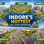
Major Growth Corridors on Indore's Urban Expansion Map
Let's break down the most important expansion zones shaping Indore's future.
Super Corridor: The Premium Growth Spine
The Super Corridor has become Indore's most strategically important urban stretch. Why it dominates the expansion map:
- Connectivity to Devi Ahilya Bai Holkar Airport
- IT and commercial developments
- Wide road infrastructure
- Proximity to MR-10 and bypass
The corridor has transitioned from speculative land parcels to structured residential and commercial projects.
MR-10 Corridor: High-Absorption Residential Belt
MR-10 connects key eastern pockets and is evolving into a high-demand housing zone. Growth drivers:
- Affordable compared to Vijay Nagar
- Strong connectivity
- Township-scale developments
- End-user-driven demand
This corridor is attracting mid-income families and developers targeting fast-moving inventory.
Eastern Bypass & Emerging Residential Belt
The eastern stretch — including Mahalaxmi Nagar, Nipania, Tulsi Nagar, and Mangliya — is transitioning from peripheral to semi-central. These micro markets are witnessing:
- Consistent residential absorption
- Gated community launches
- Improved civic infrastructure
- Increasing rental demand
Eastern Indore is one of the most stable growth zones in the city's expansion map.
Ujjain Road Corridor: Industrial & Logistics Influence
Connectivity toward Ujjain has created long-term potential in this belt. Expansion catalysts:
- Highway upgrades
- Industrial movement
- Warehousing demand
- Budget housing opportunities
This zone is ideal for land banking and early-stage plotted developments.
Khandwa Road Expansion Belt
Historically known for educational institutions, Khandwa Road is now witnessing residential township projects, affordable housing, student rental demand, and growing commercial pockets.
As central areas become expensive, demand is gradually shifting here.
Infrastructure Projects Reshaping Indore's Geography
Urban expansion is always infrastructure-led. Indore is currently undergoing transformational upgrades.
Indore Metro Impact
The upcoming Indore Metro will significantly influence property pricing near stations, commercial corridor growth, and transit-oriented development. Cities across India show 10–25% price appreciation near metro corridors post-completion — Indore is expected to follow a similar trajectory.
Ring Roads & Bypass Network
Expansion of the Eastern Ring Road, Western Bypass, and MR connectivity corridors is decentralizing traffic flow and enabling township-scale development. Peripheral areas are becoming more accessible, reducing psychological distance from the city core.
Airport & IT Influence
The airport belt near Devi Ahilya Bai Holkar Airport is pushing premium residential projects, business hotels, and corporate offices. Proximity to airport infrastructure always strengthens long-term value perception.
Migration Trends Fueling Expansion
Urban growth is incomplete without population inflow. Indore attracts migration from nearby towns such as Sanawad, Barwah, Khandwa, and Burhanpur — which lack comparable education institutions, healthcare facilities, corporate job opportunities, and lifestyle infrastructure.
As families relocate, housing demand increases, pushing boundaries outward.
Migration-driven demand creates sustainable expansion, not speculative bubbles.
Township Culture: The New Urban Identity
Indore's expansion is no longer about standalone apartments. Developers are launching integrated townships, gated plotted communities, mixed-use projects, and commercial + residential clusters.
Large land parcels on the outskirts enable planned urban ecosystems instead of fragmented construction — a shift toward structured urbanization.
Price Zonation Model of Indore
Understanding pricing layers helps decode expansion opportunities.
Core Zone
- Vijay Nagar
- Palasia
- AB Road
Transitional Growth Zone
- MR-10
- Super Corridor
- Eastern Bypass
Peripheral Future Zone
- Ujjain Road stretch
- Outer bypass belts
- Rural-to-urban conversion pockets
Smart capital enters transitional zones before full infrastructure completion.
Land Bank Opportunities in Expanding Indore
Large land parcels are still available in the Ujjain Road belt, Mangliya side, and outer bypass zones. Developers entering Indore should:
- Acquire 10–50 acre parcels
- Align with IDA master planning
- Develop phased township models
Indore's land cost to selling price gap still allows developer margins, unlike saturated Tier-1 cities.
Risks in Urban Expansion Zones
Every growth story has risk factors. Before investing:
- Verify zoning approvals
- Check road width compliance
- Confirm clear land titles
- Understand FSI regulations
- Avoid speculative unauthorized layouts
Urban expansion rewards structured investment, not emotional buying.
Absorption Trends in Expanding Corridors
Indore's real estate absorption cycle is relatively faster compared to many Tier-2 cities because of balanced supply, strong end-user demand, affordable ticket sizes, and migration support.
Mid-income housing sees the fastest turnover. Premium inventory moves slower but appreciates steadily.
Where Is Indore Expanding Fastest in 2026?
Based on infrastructure alignment and construction activity:
- Super Corridor
- MR-10
- Eastern residential belt
- Airport influence zone
- Ujjain Road early-stage parcels
These corridors represent visible expansion and future growth potential.
Indore 2030 Vision
By 2030, Indore is expected to develop multi-nodal commercial hubs, expand township-based residential clusters, strengthen metro-connected corridors, and integrate peripheral areas into mainstream city planning.
Urban expansion will convert today's outskirts into tomorrow's central zones. The city is gradually evolving from a Tier-2 city into a structured regional metro hub.
Strategic Takeaways for Investors & Developers
A Developer
- Focus on mid-income housing
- Target 10+ acre parcels
- Align launch with infrastructure announcements
A Land Investor
- Enter early-stage corridors near approved road plans
- Avoid illegal plotting
- Hold a minimum of 3–5 years
A Homebuyer
- Choose transitional zones for value appreciation
- Prioritize connectivity over brand
Reading the Urban Expansion Map of Indore Correctly
Indore's expansion is infrastructure-driven, migration-supported, and planning-oriented. The city is not expanding randomly — it is growing along clear corridors shaped by connectivity and economic activity.
Understanding the Urban Expansion Map of Indore allows developers to acquire strategically, investors to enter before appreciation peaks, and buyers to choose future-ready locations.
The next decade belongs to corridor-based township development. Those who align with infrastructure direction will benefit the most.